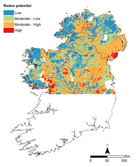
The project has investigated the use of Tellus radiometric data in the construction of an all-Ireland Radon Potential Map. Equivalent uranium (eU) from Tellus radiometric data were used to predict soil gas radon concentrations. A simplified GSI groundwater recharge map was used to estimate the sub-soil permeability (low, medium and high). Together these parameters have been used to define a Radon Potential Map. The maps was used as a means to divide the study area into four risk categories; Low Risk (<10), Moderate-Low (10-22.5), Moderate-High (22.5-35) and High (>35). Indoor radon measurements were not input as Radon Potential model parameters, so were used to validate the resultant map.
Javier Elío
Associate Professor
My research interests include environmental sciences and data analysis.